September 25, 2023
Kissimmee, Florida
Lead’Air, a well-known pioneer in the field of aerial 3D mapping technology, proudly introduces the PanthAir 3D aerial camera system, setting a new industry standard for affordability and performance.
In line with our longstanding tradition of designing and manufacturing cost-effective aerial camera systems, Lead’Air is thrilled to launch the groundbreaking PanthAir series of 3D aerial cameras, engineered with an unparalleled selling price below $200,000. To accomplish this milestone, PanthAir relies on a single camera to capture 3D stereo imagery, marking a significant advancement in the field of aerial mapping technology.
3D mapping technology requires multiple intersecting views and perspectives of terrain features and building exteriors to recreate a 3D scene. Typically, this is accomplished by deploying an array of five oblique and vertical cameras capturing diverse viewpoints and perspectives. PanthAir ‘s innovation lies in its revolving semi-oblique camera, which swiftly rotates around its axis, capturing images in all directions. Moreover, the camera’s axis is strategically inclined to ensure that, with each turn, the camera captures imagery directly beneath the aircraft (nadir) as well as at a considerable distance around the aircraft (oblique). Essentially, the camera’s oblique angle continuously varies during its rotation, allowing it to capture high oblique views of up to 60 degrees and near-vertical views within each revolution, which satisfies the prerequisites of 3D reconstruction.
Every three seconds, twelve images are captured, covering a full circle around the aircraft. To prevent image motion, the rotation halts completely for every photo taken, ensuring sharp and clear images.
PanthAir leverages the Illunis EMC-103 100 megapixels compact medium format camera. Thanks to mass production, these cameras are available at a fraction of the cost of competing medium format aerial cameras commonly used in our profession.
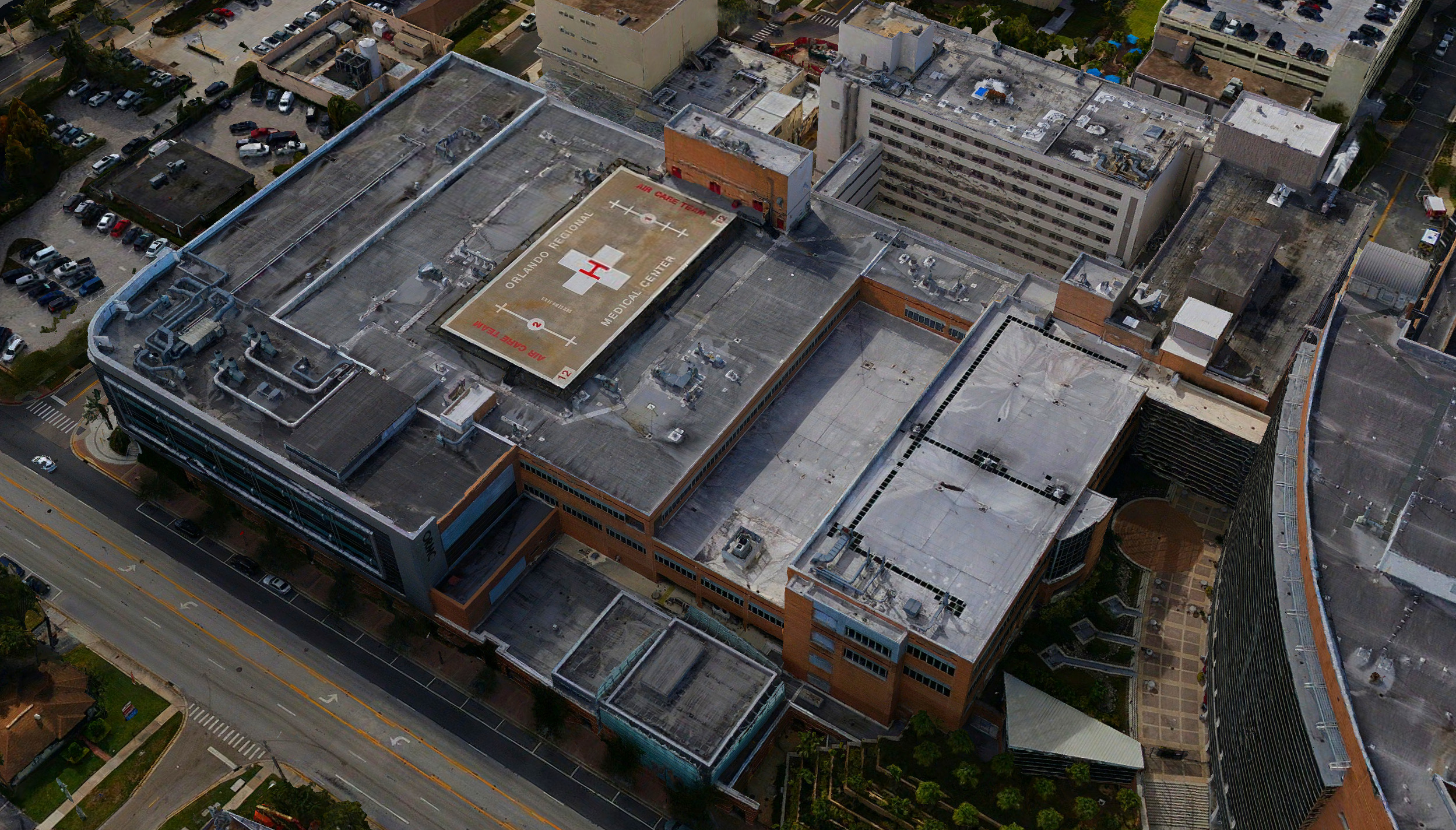
The PanthAir system has undergone extensive testing on large urban areas with high buildings like the city of Orlando. The quality of the results and the mapping accuracy results have been hailed as outstanding, and on par with any other 3D camera available on the market.
–
To view initial results, we invite you to download the Orlando mesh video, processed using Skyline Software Systems Photomesh:
Orlando PanthAir Data Set Demo
Additional tests are underway with other leading 3D mapping software, such as ESRI ArcGIS Reality Studio. Should you wish to explore these 3D models or process the dataset yourself, we will gladly provide you with the project dataset and imagery, shipped at no cost.
In summary
PanthAir’s comprehensive 360-degree capture is equivalent to that of a twelve-camera oblique system. There is no disparity between a twelve-camera oblique system, firing twelve individual cameras simultaneously, and a single-camera system that captures twelve nearly simultaneous photos from the same directions and angles.
Compared to the fragmented perspectives captured by traditional five-camera cardinal oblique systems like our own MIDAS, where each perspective is isolated and unrelated, PanthAir captures an all-encompassing 3D image cone with abundant overlaps between each image. Instead of scattered and disconnected images, PanthAir offers comprehensive continuous stereo coverage with optimal perspectives.
Lead’Air firmly believes that the next-generation PanthAir systems will democratize the 3D aerial mapping market, providing access to smaller operators and companies previously excluded due to the exorbitant prices of existing 3D aerial cameras.
For additional information, please contact us at:
Lead ‘Air
113 Hangar Road
Kissimmee, FL 34741
USA
Website: https://trackair.us
Email: sales@trackair.com
Tel: +1 (407) 343 – 7571